Showing posts with label Geography. Show all posts

Monday, September 24, 2018

Learning About New York City

The last time I did a review for By the Way, it was for their book on Florida.  It was a perfect fit for this east coast family who lived in Florida for several years.  We are back to the By the Way Book Series and this time around we got to review New York City- By the Way.  Pretty perfect since we have a NYC loving daughter who has gone twice and will try to get anyone she knows to go with her again.

 Ironically she is at school finishing up her senior year, so her youngest brother, age 11, and I have gotten to read this cool book before her- shhhh, don't tell!

The By the Way book series has an ever growing title collection including Ireland, Alaska, Indiana, Colorado and more.  These books are indeed a story, following Alex and Lexi on an adventure to a specific location, but they are also so much more.  Each book is packed full with information; the newest ones even more so than before.  Inside each hardback book you will find geography, history, science and more.  Each page has engaging color pictures to hold the interest of younger children, but the facts you will learn are perfect for your whole family.


Within each book, written by author Joy Budensiek, is the intent to teach kids about God and His world and His truth.

"Discovering Biblical Truth in Everyday Life"

Scripture is quoted often, but in a natural, conversational way.  It is way to present a Christian worldview and open up conversations with your children about God in a relaxing, non-threatening environment. 

New York City- By the Way is a 48 page book of fun!  Alex and Lexi are joined by their classmates on a three day trip to New York City with their teachers. Each day is packed with activities where they learn that, despite being in a busy city, they can still see evidences of God in nature.  While exploring they see many animals including squirrels, ducks, and pigeons. 

They also learn about turtles, coyotes. and butterflies. When trivia is mentioned throughout the book you will often find side boxes with facts about that specific thing.  Consider it a mini encyclopedia lesson!


Also included in the New York book is a whole lot of geography and history.  As the class travels to all 5 of the city's boroughs, they learn about the 175 zip codes that are there and check off as many as they can find as they explore.  They also learn about the history of each area and other neat facts.

How we used this book and what we thought of it-
Like usual, Colby (6th grade) grabbed this book and read it before I had a chance to.  This is NOT a one sitting book!  It is more like a chapter book, but without the chapters.  I think he read it over the course of a few days and he is a pretty voracious reader.  If you are using it as a read aloud, I recommend you take it in chunks- there is so much to absorb and talk about.


I did finally manage to read it on my own and did so in one sitting.  Colby had mentioned several things he thought were interesting, but it was more fun to engage him in conversation after I had read it too!  Sometimes what I find neat is not always what interests him.  Some topics we learned about include-
  • The Subway System
  • The Statue of Liberty
  • 9/11
  • Street Vendors
  • Tube Mail
  • Central Park
  • Chinatown and Little Italy
  • Fanny Crosby
  • The Empire State Building
  • Geo-caching
  • The Bronx Zoo
Of course, this list is just the tip of the iceberg!  I told you these books were a wealth of information!

So my favorite part- hard to choose!  I loved reading about some of the older history of the city, especially about the immigrants who came by way of Ellis Island.  Did you know that in one single day in 1907, almost 12,000 immigrants were processed.  That absolutely amazes me.  Another thing that blew my mind- there are 138 languages spoken in Queens alone!  Can you just imagine what it would be like to hear even just a fraction of them all at once?  No wonder the city is so loud!

And Colby's favorite parts?
Colby LOVED ready about Winkie! She is actually a pigeon, one of 32, that was awarded the Dickin Medal for serving in WWII.  When the ship she was on went down in the North Sea, Winkie flew 120 miles back to her owner and is credited for saving the lives of all the men on the ship.


He was also shocked to learn that there are 5.2 million trees in NYC, with 592,130 on city streets.  Like he said... "who knew?"
There is also a fun picture search where you find 10 pictures hidden throughout the book to entertain and challenge your younger kids.  It might be a way to help keep them engaged if the story gets a bit long for them.

Whether you are a unit study kind of mom, a history and geography fact kid, or just looking to add beautifully illustrated books that teach God's word, you will love this By The Way book series!  The only problem- choosing which one to start with!


By the Way Book Series: New York City, Ireland, Indiana & Alaska {By the Way Reviews}
Crew Disclaimer

Friday, September 22, 2017

Who Is Up For Some World Traveling?


Oh my word, friends, you know that sometimes I find a curriculum that I love and gush about, right?!  Well, get ready because Let’s Go Geography is one of those programs.  Seriously, let me tell you about this three year Geography program developed for Grades K-4th that we were able to review for the Homeschool Review Crew.  The one year subscription we reviewed can be used by one teacher for one child to multiple children at home as well as even for a co op group!

Created by Carol Henderson, a school teacher, Let’s Go Geography is unique in several ways.  First of all its focus is on exploring the continents, country by country, not just physical attributes like rivers and streams and mountains you often find in lower graded Geography programs.  This 36 week program, with three scheduled breaks built in, will eventually cover three years and most countries, including the United States.  The first year is currently available with the next two years coming soon.  Each year, two regions of the United States are covered. You can purchase a whole year at a time, or buy by semester if you want.
Let's Go Geography

Another unique feature of Let’s Go Geography is that it is online with live links!  You can download each lesson or just go through it online, using the clickable links to explore specific facts that the author presents. 


When you begin the program, your child can choose from several Travel Journal covers to add to the notebook they can make, as well as print off a “passport” in which they will add flags of the countries they will visit in their studies.  


Another unique feature is that you can study the countries in any order.  While the program is designed to be worked through in order, you CAN jump around. Once you finish each lesson there is a button to click on so you can mark it as completed, making it easy to see what you have done at a glance.

Each lesson is set up in the same way, composed of 5 parts.  After the country is introduced with a page of quick facts such as capital, population, official language and such, a check list of the 5 components is included.

  • Color the Map- This section includes a link to a map you can print out, with directions to color the country, and label it accordingly.  Often other areas around the country are labeled as well, such as oceans and seas.


  • Flag- This section includes a picture of the country’s flag that you can cut out and color, then add to your passport.  There is also an option to add the flags to continent maps. A few notes about the flag and what the colors and symbols represent are presented.


  • The Music- This section has a link to the music that represent the country.  Some times it is the national anthem, and other times it is an example of local music that may be more familiar.
  • Explore- This is the meat of the program.  Here you will find facts about the country.  Most sections have a link to another video that further exposes your child to the subject being learned.  Color pictures are also included for your child to look at in this explore section.


  • Craft- This final section has a craft for your child to do that represents the country they have been studying.  The theme of the craft is presented as well as a supplies list.  Detailed instructions, including picture examples, are included.  There is also a color sheet to print out.


Additional resources include a notebook page for your country for your child to write on if you desire as well as any printables you might need for the lesson or craft.  The ISBN number for related books are listed as well for further study.


Our thoughts and experiences-
Ok, here is where you brace yourself for the gushing.   Yes, this program is aged for K-4th grade.  And yes, Colby is on 5th.  NO worries.  Truly, I think the ages are good, but I think you can easily use this with slightly older children as well.  The information presented is thorough, but you can certainly use it as a jump start to a more detailed study if you wish.  Often the reading and the videos would lead us down rabbit trails to additional information.
I love how organized this program is and how accessible it is.  Colby can pull this program up and do much of it on his own, though I admit I do not let him often, as I enjoy doing it with him.  Each time you bring up your homepage, a list of the year is on the left sidebar and shows what lessons are complete and which ones are not. We have chosen to break the lessons into two days, one day working through the lesson and a second day to write a quick report on the notebook page provided and doing any craft or color sheet included.  Because I am working with a non-crafty kind of guy, he has chosen not to do too many of the crafts and I have to color with him to complete the pictures.  Go figure!  That being said, you can easily do the lessons in one sitting or stretch them out for a week, depending on your child's needs and attention span.

This little gem is made for ALL learning types!  Auditory, visual- you name it, it is covered.  Have a child that loves crafts?  They will be thrilled with the projects like making rainsticks and kites and doing coloring sheets.  Have a more visual learner?  The YouTube videos are short enough to not bore anyone but filled with interesting facts and sights!   


I also love that you can print the lessons out.  While we did work from the computer to access all of the links (Colby's favorite part), I like having a record of what we do.  I print out most of the pages and we are adding them to Colby's Travel journal.  We label each country with a sticky note so he can easily reference them if he wants. 


I love that you can skip around.  I have a kiddo that likes to be in charge.  Obviously, he cannot be very often...he is 10 after all.  But anytime I can allow him to make decisions, I do so.  This has been the case for Let's Go Geography and the reason you will see Afghanistan on the tab up there.  Because his dad was stationed there for a year it interested him.  As did Hawaii because "It would be a cool place to visit!" and Greenland because he thought that might be "cool" as well. Chili is next because it is "close to where I was born."  His favorite video so far?  During the Greenland national anthem video you see an iceberg start to collapse in the background.  It was neat!  I figure if he gets excited about choosing, it is the least I can do. ;)

So like it?  Yes, we do!  
Recommend it?  You bet!

Let's Go Geography has a been a HUGE blessing and great addition to our weekly studies and I am thrilled we found it!

 
Let’s Go Geography {Reviews}
Crew Disclaimer

Wednesday, January 28, 2015

Wordless Wednesday

This, my friends, is how we do geography!  States and capitals Sequence!


Wordless Wednesday at Life at Rossmont

Monday, January 19, 2015

Around The World

Welcome to Week 3 of the Virtual Curriculum Fair- Exploring Our World, co-hosted by Susan of Homeschooling Hearts & Minds and Stacy of  Super Mommy to the Rescue.


Weeks one and two were busy and I am just as excited about this week!

Today is all about History and Geography! I have a house full of history lovers.  They did not get that from me, by the way, but they do keep me entertained with many useless useful facts during the day.  It is helping me make up for the fact that I did not pay attention to much history in high school.  Sad, but true.  But honestly, if I had heard history like my kids are hearing history I truly believe I would have listened more.

For the 2nd grader-
THIS IS MY FAVORITE!  Veritas Press Self Paced History  This computer based program has been a huge blessing in our lives.  It keeps my son engaged, teaches history from a Christian worldview, and is worth every penny.  We will actually finish this one in about five weeks from now because CJ often doubles up on lessons (he likes it that much!) and I cannot wait to start the next one.  My original plan was to have him do this program independently, which he sure could do, but I am learning so much that we do it together most of the time.  Although we are going to be done with our current level in a few weeks we will not wait until next year to begin again - we can't wait to start the next time period!


For the 7th grader-
Notgrass History- Uncle Sam and You
If you have not used Notgrass, I highly recommend it.  Yes, it is a "typical" textbook experience, but the information is engaging and very well done.  My son always does it early in his school day because he really enjoys it.  You can incorporate literature, Bible, and writing with it but we are not doing that at this time. We do however use the activity book you can purchase separately for a review each day.

For the 11th grader-
She is doing Sonlight's Government program.  This is what we started with our first child so we have just continued it.  It is a solid program and there was no reason to buy anything new at this time.  Depending on how we feel about the higher levels of Notgrass next year, this may be the last time we use this one since my son really likes Notgrass.  Remember, one of the joys of homeschooling is that you can customize your program to fit each child and their learning styles as well as their interests!

And a quick glance at Geography-
Every year is different for us and right now we do not have any specific curriculum we are using for Geography.  Veritas includes Geography in the lessons so I feel for now the 2nd grader is covered.  The other thing we use for him is the If You Were Me and Lived In ...series.  Such cute books and such good information.  He loves them all, but his favorite is the one about Australia!

The other Geography that I highly recommend happens to be Maps, Globes, Graphs Series.  It may seem basic for some, but it really covers many of the skills that your child will be tested on with standardized testing. Because you can pick a level, it is easy to use as a fill in for anything else you may want to use.

To get a glimpse of what others do, here is a list of some friends who are also participating in this week's VCF!  Explore and enjoy!


Exploring World History Through the Eyes of Scientists by Susan @ Homeschooling Hearts & Minds
Exploring Our World With Social Studies by Stacie @ Super Mommy to the Rescue
Relaxed Homeschooling: Science and Social Studies in the Early Elementary Years by Brittney @ Mom's Heart
Living History by Sarah @ Delivering Grace
Classically Influenced, Project Strong, Adaptable Middle School History by Christy @ Unexpected Homeschool
Primary Sources for Delight-Directed History by Susan @ The Every Day of Education
Watching History, or Using Video Courses for Social Studies by Debra @ Footprints in the Butter
Exploring our World: High School Studies of Ancient History, American Government and Economics by Laura @ Day by Day in Our World
History, Geography, and Worldview Lessons in Our Homeschool by Jennifer @ A Glimpse of Our Life
Our Curriculum Choices 2015 ~ Science, History & Geography by Renata @ Sunnyside Farm Fun
Our Favorites for History, Geography, and Science by Becky @ Milo & Oats
Globe Trotting by Lisa @ Golden Grasses
Bible-Based History Curriculum and Resources by Tauna @ Proverbial Homemaker
13 Living Book History Series for a Charlotte Mason Based Homeschool by Chelli @ The Planted Trees
Social Studies and Science in Our Classical / Charlotte Mason Homeschool by Sharra @ The Homeschool Marm
The Science Life by Laura @ Four Little Penguins
History, Geography Science for 2015 by Chareen @ Every Bed of Roses
History Social Studies and Science...VCF Week 3 by Denise @ Fullnest
Learning About our World and History by Joelle @ Homeschooling for His Glory
Taking the Mystery Out of History and Other Subjects Too With Our Favorite History Curriculum by Amy @ One Blessed Mamma

Blessings,

Wednesday, June 12, 2013

TOS Crew Review- Geography 1

Do you ever just want to start over with homeschooling?  OK, maybe not start over with the years, but with the curriculum?  Occasionally I get that crazy thought- and the company Memoria Press would be one of my biggest temptations!  Have you seen their foreign languages?  Have you seen their complete curriculum?  I love it!  All! 
 photo mp_header_zps9aa8d9dc.jpg


So yes, I was thrilled to be able to review Geography I, for grades 4-8, from Memoria Press. Geography of the Middle East, North Africa, and Europe covers the area that we know as the ancient Roman Empire.


 photo Geography1-CompleteSet_zps84b09173.pngHere's what it came with:
Geography Text (text sample)
Geography Workbook (workbook sample)
Teacher's Guide
United States Review- Student
United States Review Key, Quizzes, and Tests


What is this-
Let's start with the Student text. There is a great little introduction to Geography and then the rest of the book is broken into geographic regions- Middle East, North Africa,  and Europe.  The last few pages of the book have full color photos of each country's flag.  For each country (44 total) there is a full page map, Fast Facts section, History Headlines and Tour of Today.  The fast facts include the capital city and any major cities, language, population, religions, landforms, bodies of water, climate, resources and flag information.  There are also several pictures of places, people or things of interest.  The History Headlines is a brief description of the country's history while the Tour of Today gives some facts that are more currently relevant.
 
The student workbook then contains a one page spread per country for your child to list the country and capital, ancient name, a few fun facts they learned and has a smaller map to label with key features such as the capital, neighboring countries, rivers and landforms.  At the end of each region there is a review map to fill in with all the countries learned thus far and then a page to list the countries and capitals. 
 
The teacher's guide contains all of the answers you will need as well as quizzes and tests.
 
The Student workbook for the United States Review is slightly different as it is truly map work only, dividing the United States into 8 regions as well as space to write the states and capitals on each page.  Again, the teacher's key contains the answers, quizzes and tests.
 
How we used this program-
I used this program for our 5th grade son.  He has been studying the Eastern Hemisphere this year and has just completed his studies, so once again the timing was perfect for us to review this!  It gave him a chance to review what he had learned, solidify his map and capital knowledge and learn a few new facts along the way.  I had him do one page per day, though the teacher guidelines recommend 2-3 countries a week.  He would read the worktext on his own and then find the corresponding page in his workbook to complete.  Once he completed each section and its review,  he would let me know and then I would give him the test to take.  Students are tested on the map work only, not the facts learned in the text.  We opted not to do the quizzes.
 
What we thought-
We really liked this product, though I should not be surprised...I have liked everything I have ever used from Memoria Press.  Their workbooks are great quality and well organized.  One of the things my son and I found refreshing for a geography program was that this one did not just concentrate on maps alone.  It's not always fun to just memorize a map, but when you can throw in some fun and interesting facts along with the map it just seems to hold a student's attention better.  At least mine!  Not once did he complain about doing Geography and more than several times he came in to share things he had learned in the reading.  I love that this program is able to be used by the student alone with little guidance and has built in reviews before test time.  We did did not begin the United States Review book yet, but are going to make that our Geography for next year instead.  While it does not have the reading text included and really is to be used as a review, I think it is still an excellent way to learn states and capitals, which we have not done yet, as well as the map work. 
This is a good, solid program and for the price
I think it is more than worth it!
Geography I complete set, as we reviewed it, can be ordered for $48.00.  You can also buy the components separately if needed.


Photobucket


Thursday, July 19, 2012

CREW Review- Knowledge Quest Map Trek


Knowledge Quest is an amazing company dedicated to making history come alive with incredible books, time lines and maps.  In the past, my family has used the Wonders of Old Timeline book and loved it.  For this review we got to try something new, the Map Trek: Complete Collection 6-Ebook Set.  I am hooked.  Well over 400 maps WITH lesson plans!


Let me first tell you what you get!


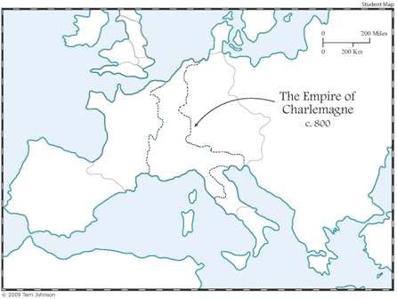
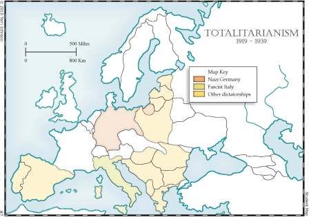
With this downloadable option you will get Four World History Ebooks (Ancient, Medieval, New World and Modern) and two US History Ebooks (one with state maps and one with historical maps).  Each map has the teacher's edition which is multicolored and labeled with key features, as well as the student edition which is ready to be filled in by the student.  The state maps include the date of statehood, the capital, main rivers and waterways, rank in size, state bird and the state flower.  You can print off each map as you need it in your study or you can print them all out at once and with the help of the lesson plans use each set as a unit study! 


Let's talk lesson plans!  Each Ebook comes with lesson plans to help you use the maps in a study situation.  The lessons plans are broken down into three levels:

Level 1- Grades 1-4
Level 2- Grades 5-8
Level 3- Grades 9-12

Each level gets increasingly more challenging, allowing you to use the maps for many years, teaching new skills and information as your child grows older.


Here are some of the many things we like about using these maps;

-They are beautiful!  Multicolored teacher's maps are more detailed than your run of the mill outline maps and beautiful to look at.  Visual interest seemed to draw my kiddos in!

-They are easy to access and print out.  This is an easy download and very well organized set.

-They can easily be used as a stand-alone curriculum or linked with your favorite history program!

-And my favorite- Knowledge Quest has Curriculum Integration Guides.  Yes,
they have done the hard work and given us a guide to link the most used history curriculums out there to their maps.  In other words, when you study a specific section in your history curriculum, Knowledge Quest will direct you to a correspnding map in their collection.  This list includes Sonlight, Story of the World, Veritas Press, Streams of Civilization and more.  Just print the guide off, pop it in your notebook and you are ready with maps to further enhance your study.

-Oh, and one more fun thing.  Since we have taken a few weeks off of school, we have not had much history to link with maps yet.  But, using my blog visit history, we have been able to learn a lot of geography using these maps.  We printed out all of the continent maps and each day we check which new countries we have checking in here at Family, Faith and Fridays and then find them on our maps.  A great geography lesson!

For $47.00, you cannot beat this deal! Click here to order! There is also a hard covered Atlas with CD available for $55.00.

To see what other CREW members had to say about Map Trek click on the banner below.


Photobucket
 
 
Disclaimer- Our family received Map Trek: Complete Collection Ebook in exchange for our honest review of the product.  The views stated are our own and were not influence by the company in any way.